
The Wine and Stone Trail
Eight stages that preserve an ancient land
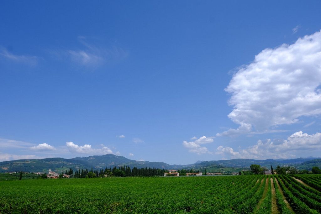
The trail crosses a vast and ever-changing landscape, from the hills of Valpolicella to the high pastures of Lessinia, before descending once again into the valley. We are in the northwestern part of the Province of Verona, between the Adige River and the limestone peaks of the Lessini Mountains—two distinct landscapes bound together by centuries of shared history and culture.
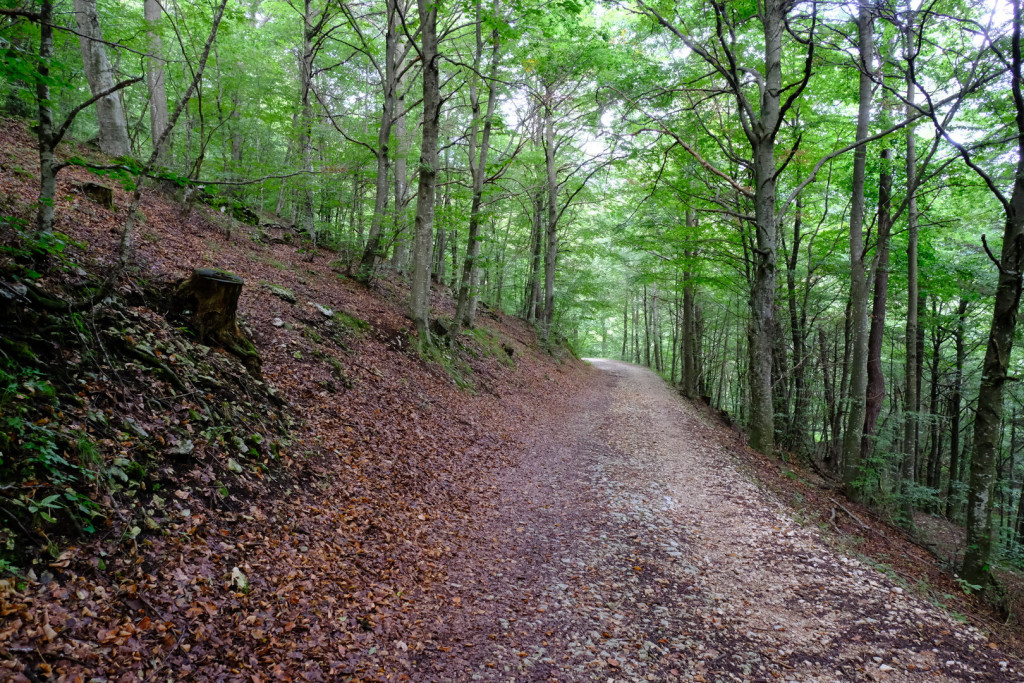
Walking here means tuning in to an environment that changes with every step: neat rows of vineyards give way to woods, stone hamlets, open pastures, and rocky outcrops. There is no sharp boundary between Valpolicella and Lessinia—and that is the beauty of it: you pass from one to the other almost without noticing, fully immersed in a living landscape rich in history and human presence.
Valpolicella is world-renowned for its great red wines, especially Amarone, but proudly displays traces of a much older past: from Paleolithic archaeological sites to Roman remains like the Temple of Minerva in Marano and the Villa of Mosaics in Negrar. Medieval churches, large parish churches, small village chapels, stone crosses, and votive shrines speak of centuries of faith and tradition. In more recent centuries, the valley has been enriched by numerous Venetian villas, surrounded by gardens, parks, tree-lined avenues, and stone walls that shape a truly unique hilly landscape.
As you climb into Lessinia, the landscape opens up and takes on a new character. You enter the Lessinia Regional Nature Park, a protected area filled with geological, natural, and historical marvels: from the spectacular Molina Waterfalls to the monumental Ponte di Veja, one of the largest natural rock bridges in Europe. Here you’ll encounter stone quarries—some still active—and ancient mountain settlements where stone has been shaped over the centuries to build roofs, fountains, and dry-stone walls. The high pastures offer wide open spaces, ideal for summer grazing, and breathtaking views that stretch into the distance.
On clear days, from these heights you can see the Brenta Dolomites, the Monte Baldo range, the Adige Valley, the Veronese plain, and even the Apennines on the horizon. These are vast, silent panoramas that reward the effort of walking and invite contemplation.
Human presence has also left a deep mark. In Lessinia, you can still sense the influence of the Cimbri, a Germanic people who brought their language, architecture, and traditions. The mountains were lived with ingenuity: pastures, mills, barns, fountains, and stone paths speak of a hard life, deeply rooted in respect for the land.
Today, those who walk this route do so out of passion, a desire for exploration, or the simple joy of walking slowly. And it is precisely that slow pace that allows one to perceive the signs of past and present, in a landscape that changes with the seasons—keeping memory alive while sketching out a future in constant transformation.
Map and Route Info (Without Variants)
- Total distance: 160 km
- Minimum elevation: 99 m
- Maximum elevation: 1,750 m
- Total ascent: 6,155m
- Total descent: 6,155 m


Waymarking
The Cammino del Vino e della Pietra is fully signposted along all 8 stages.
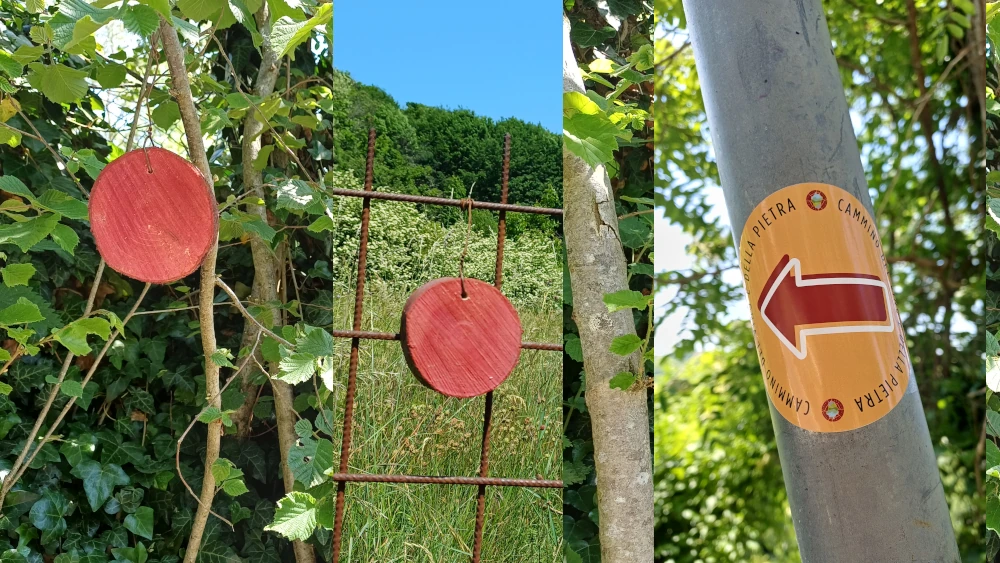
The main signage consists of burgundy-coloured circular wooden trail markers, placed along the route with respect for the surrounding environment, and directional arrow stickers used wherever possible and permitted.
The alternative routes are also marked with dedicated trail signs, making them clearly distinguishable from the main route.
Approximately 55 km of the Cammino follow CAI trails, which already have their own hiking trail signage.
The signs along the route are complemented by the official GPX tracks and maps available on our website. Each stage has its own GPX track and a detailed description with useful information for following the route.
We recommend downloading the GPX track for each stage to your device before setting off.
Where to Eat and Where to Stay
The description of each stage includes accommodation facilities and places to eat located along the route.
A dedicated map is available for each stage, showing the listed establishments, including the Friends of the Cammino.
The list is continuously updated and will grow over time as new local establishments are added.
The Friends of the Cammino are establishments that share the spirit of the project and support its development throughout the local area. Some of their owners have personally joined the Association, sharing its aims and Statute, which place relationships, the local area and people at the heart of the project.
View the general interactive map of the Cammino showing the listed establishments (under construction).

Water
Drinking water is available only at certain points along the route.
Although there are active springs and fountains along the Cammino, in most cases they are not certified as sources of drinking water. It is therefore essential to always set out with a sufficient supply of water, appropriate for the length of the stage, the season and the weather conditions.
Proper water management is an essential part of staying safe along the Cammino.
Only 8 stages?
Thanks to the alternative route connecting the main trail to Sant’Anna d’Alfaedo, the Cammino can be divided into two sections, consisting of five and three stages respectively. This creates two separate circular routes, offering a useful option for walkers who have fewer consecutive days available.
The first loop, dedicated to Valpolicella and the lower Lessinia, involves a slight change to the route. Instead of completing the third stage in Fosse, walkers take the alternative route leading to Sant’Anna d’Alfaedo, which becomes the new destination for the day. From there, the following two stages complete the five-stage lower loop.
The same alternative route is also used for the upper Lessinia loop. This second route begins and ends in Sant’Anna d’Alfaedo and follows the three highest stages of the Cammino, forming a complete itinerary in its own right.
Although the Cammino can be divided into two separate journeys, we still recommend walking the entire route—either in a single journey or over two different periods—to fully appreciate its value and understand its overall character.
Why wine?
For more than two thousand five hundred years these hills have been a land of vines and wine. The origins are lost in time: the Etruscans may have introduced viticulture, but it is certain that the Romans regarded it as highly valuable. At the beginning of the 5th century, at the end of the empire, Cassiodorus, secretary to the Ostrogothic king Theoderic, wrote a letter to the people of Verona praising a dense red wine, and also a white one, almost something to be eaten, obtained by letting the grapes dry before pressing. A description that anticipates by centuries the techniques used for Amarone.
During the Middle Ages, Valpolicella wine supplied the many lively inns of Verona. Meanwhile, in the countryside, nobles and landowners cultivated vines for their own use, often around Venetian villas, turning wine into a precious good and a symbol of prestige.
A major turning point came in 1969 with the creation of the Valpolicella DOC specification, which strictly defined the production area, grape varieties and production methods. Along the entire hilly belt of Verona, from Negrar almost to Soave, only a few denominations can be produced today:
Valpolicella Classico and Superiore, dry and fresh red wines,
Valpolicella Classico (in the historical area),
Valpolicella Superiore,
Amarone della Valpolicella DOCG, a powerful red made from dried grapes,
Recioto della Valpolicella DOCG, its sweet and ancient counterpart,
Valpolicella Ripasso DOC, a wine “re-passed” over the pomace of Recioto or Amarone, inheriting their body and aromas.
The main grape varieties are Corvina (45 to 95 percent), Corvinone (up to 50 percent), Rondinella (5 to 30 percent) and other authorised red varieties from the Province of Verona (up to 25 percent).
The traditional training system is the Veronese pergola, with shoots arranged horizontally to form a sort of canopy. This structure protects the grapes from sun and humidity, encourages temperature variation and helps in selecting the best bunches, especially those intended for drying.
Walking through these vineyards means experiencing a tradition rooted in ancient history yet still very much alive today, season after season, harvest after harvest.
Why stone?
Walking along this route, it is impossible not to notice how present stone is everywhere: in walls, roofs, doorways, paving, fountains and boundary markers. In Valpolicella and Lessinia, stone is not only part of the landscape but also a form of memory, culture and living material that has shaped villages and hamlets for centuries.
There are mainly two types of stone, both ancient in origin and of great value: Verona red marble, a limestone technically known as Rosso Ammonitico, and the Prun stone, or Scaglia Rossa Veronese, known for its natural layered structure in thin slabs.
Red marble was already being quarried in Roman times, especially in the area now known as Sant’Ambrogio di Valpolicella. From there it was transported along the Adige River to Verona, where it was used to build monumental structures such as the Arena, the Roman Theatre and the ancient city gates. From Verona it also travelled to other cities of the Po Valley, and many columns, capitals and sculptures in Romanesque cathedrals of northern Italy are carved from this strong and striking material.
Around this marble, over the centuries, an entire world of stonecutters, sculptors and architects developed, exporting their craft even overseas and leaving an imprint that extends far beyond the borders of the region.
Prun stone, on the other hand, is more modest but no less fascinating. It occurs naturally in thin overlapping slabs, about seventy layers separated by a very thin line of clay. This structure makes it ideal for roofs, floors and masonry. Since antiquity it has been used in houses, farm buildings and property boundaries. The Villa of the Mosaics in Negrar, dating to the 3rd century AD, still preserves traces of it in its original floors.
Until the mid-twentieth century, stone was quarried in underground galleries. The first quarrying area was between San Giorgio and Monte Solane, and later the area just above Prun became established. Today it is quarried in higher areas where the slabs lie close to the surface.
The availability of slab stone gave rise to a distinctive architecture, that of the stone villages, which deserves to be better known.
Credential
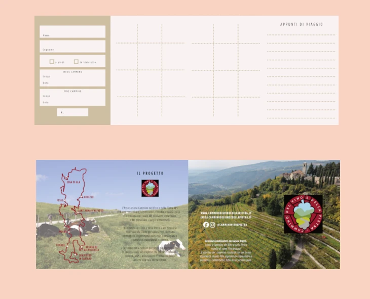
The Pilgrim Credential is your travel companion: a personal document that can be stamped along the route, recording the stages you have completed and preserving the memory of your journey.
You can collect it free of charge at the designated distribution points or download it online as a PDF and print it at home.
During your walk, ask for a stamp at participating locations displaying the Camino logo (accommodation facilities, local shops, cafés, cooperatives, tourist associations, and other partner organizations).
If you collect at least ten stamps, you can receive the “Camminante” certificate as a keepsake of your journey along the Cammino del Vino e della Pietra.
During this initial phase, simply send us a photograph of your stamped credential by email. We will then send you your well-earned certificate in PDF format.
The credential is not mandatory, but it is a valuable tool for enhancing the walking experience. Through its use, we help support the local area and encourage the development of better services and hospitality for future walkers.
Distribution Points
The Hiker’s Credential can be collected from:
Osteria San Giuseppe
Piazza San Giuseppe, 3 – San Pietro in Cariano (Verona, Italy)
Website: https://www.osteriasangiuseppe.eu/
Osteria San Giuseppe is the first official distribution point for the Camino del Vino e della Pietra Pilgrim Credential and represents a symbolic starting point for those wishing to begin their journey through the landscapes, traditions, and heritage of Valpolicella.
A special thank you goes to the owners and staff of Osteria San Giuseppe for their availability and support during this initial phase of the project. Their collaboration has made it possible to establish a concrete reference point for the first walkers who choose to explore our route.
During periods when Osteria San Giuseppe is closed (we recommend checking opening times in advance on the venue’s website or official channels), credentials may be requested by writing to info@camminodelvinoedellapietra.it. The Camino team will provide all necessary information regarding collection or delivery.
As the Camino grows, additional distribution points may be activated. Any new locations will be announced and updated on this website.
Voluntary Donation
The Pilgrim Credential is provided free of charge. However, a voluntary donation to support the project is greatly appreciated.
Every contribution helps the Camino del Vino e della Pietra grow, improve the maintenance and promotion of the route, and cover the costs associated with maintaining the website, producing and printing credentials, maps, and other informational materials made available to walkers.
You can support us via Satispay by searching for “Cammino del Vino e della Pietra”, or by making a donation using a debit card, credit card, or PayPal through the following link:
Thank you for your support, and enjoy your journey along the Camino!
Stamps
(Distribution along the Camino will be completed during summer 2026.)
Each stage of the Camino del Vino e della Pietra is identified by its own unique stamp, inspired by symbolic elements of the local territory. As they travel along the route, walkers will be able to collect different stamps from stage to stage in their Pilgrim Credential, creating a personal record of their journey through landscapes, villages, traditions, and local heritage. Each stamp represents a distinctive feature of the area crossed by the Camino, turning the credential into both a practical travel document and a lasting souvenir of the experience.

Head Office of the Cammino del Vino e della Pietra
(for information and membership)
Viale Verona 107 – Fumane (VR)
Important notice
The Cammino’s head office is currently located in Fumane, about two kilometres from the official starting point of the route. It does not coincide with the beginning of the first stage. The office is not the starting point of the walks, but the administrative and information centre of the Association.
Pilgrim passports (credentials) can be collected in San Pietro in Cariano, unless already requested by email, at:
How to Get There by Private Transport
Take the Verona Nord exit and follow the SS12 towards Valpolicella. After about 12 km, you will reach a first roundabout: take the first exit. After passing a second roundabout, at the next one take the first exit again onto Via Mara. After about 100 meters, on the right, you will find IIS Calabrese-Levi.
Continue along the same road until you reach Piazza San Giuseppe, where a large free parking area is available.
From Lake Garda or Valdadige
Once you reach Domegliara, follow the signs for San Pietro in Cariano (towards Valpolicella) and continue to the town. Once there, follow the directions above to Piazza San Giuseppe.
Parking Areas
San Pietro in Cariano has numerous free parking areas, as shown on the map. The one in Piazza San Giuseppe (the starting and ending point of the route) is naturally recommended. There are also several free parking spaces along the streets throughout the town, but it is advised not to leave your car on Via Beethoven, where the weekly market takes place, or in the parking area on Via Barbassa, which is also used for markets.
Getting There by Public Transport
From Verona Porta Nuova (train station)
From the Verona Porta Nuova railway station, you can reach San Pietro in Cariano by bus no. 21 or bus 93, with many daily services. The bus is bound for Domegliara station and also stops in San Pietro in Cariano, in front of the pharmacy, after about one hour.Continue on foot and turn immediately left onto Via Roma, following it past Piazza Ara della Valle. Continuing along Via Roma, you will reach a small roundabout; turn right onto Via Molino and shortly after you will arrive at Piazza San Giuseppe.
From Domegliara train station
For those arriving by train in Domegliara, simply take a bus towards Verona and get off after about 20 minutes at the San Pietro in Cariano stop. Continue on foot and, after passing a roundabout, turn right onto Via Mara; following it to the end, you will reach Piazza San Giuseppe.
Why choose public transport?
We strongly encourage travelers to arrive by public transport whenever possible:
it’s the best way to enter the spirit of the Cammino, reduce your environmental impact, and begin the journey with awareness and a slower pace.
Always check updated schedules
Timetables may vary depending on the day: https://www.atv.verona.it/orari_linee_bus_extraurbani