


Stage 2
From Fumane to Molina
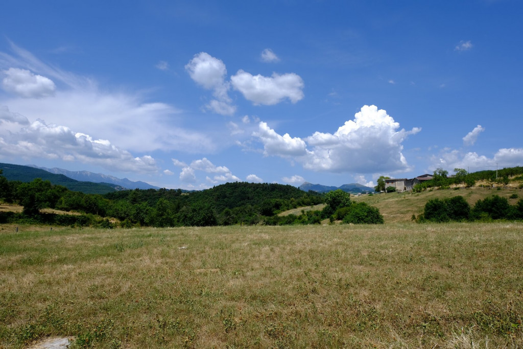
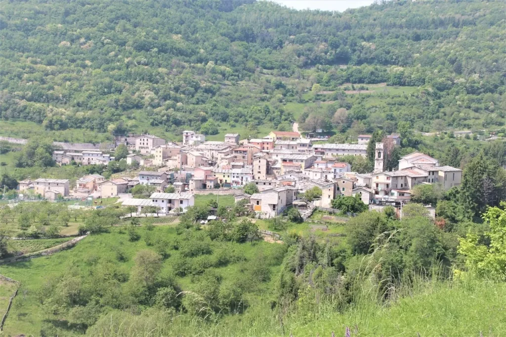
With this stage, you leave behind the plains and hills of Valpolicella and begin to climb toward the mountains. The route winds along roads and paths that gradually gain elevation, entering the territory of the Lessinia Regional Natural Park. The landscape changes: vineyards give way to forests, clearings, deep valleys, and ancient stone walls. The stage ends in the historic village of Molina, known for its cobbled courtyards, stone houses, and a quiet, authentic atmosphere.
Route
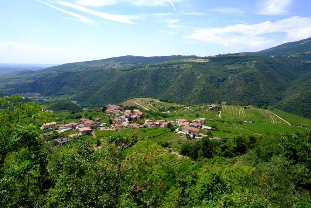
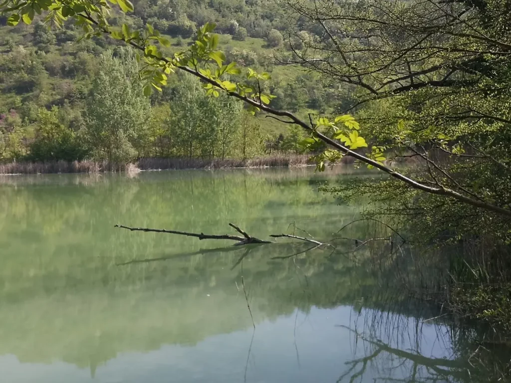
The stage begins by leaving the village through the ancient hamlet of Isola, where the stone houses still reflect the valley’s rural identity. The route then follows the path climbing towards the Valpolicella Park, a significant example of environmental restoration of a former quarry, now returned to nature and the local community.
From the park, you reach the historic hamlet of Purano, access point to CAI trail 231, which you continue to follow. The route ascends gradually to the Church of Santa Maria Valverde, set in a commanding position on one of the most scenic viewpoints in Valpolicella, with sweeping views over vineyards, rolling hills and the pre-Alpine ridges.
The walk continues alongside the archaeological area of the Roman Temple of Minerva, recently brought back to light and bearing witness to the Roman presence in the valley, before passing through the village of San Rocco.
You then leave the CAI trail by turning left onto a minor road that passes several scattered rural hamlets, eventually reaching Malga Biancari, a historic community mountain hut and an ideal place for a restorative break.
Continuing right, the route climbs to the hamlet of Baiaghe di Sopra, where you rejoin CAI trail 231 towards the picturesque village of Mondrago. Here you turn left onto CAI trail 252, which you follow for 4.56 km. Passing through Costa, you reach the village of Cerna.
The route continues along the same trail to the village of Spiazzo, then descends towards the Vajo delle Scalucce. When the path becomes steeper and bends left downhill, you leave the CAI trail and continue straight on a gentler track until reaching a road near the junction for Zivelongo.
Turning left and following the low-traffic country road for about 3 km, you finally arrive at the village of Molina, one of the most charming stops along the route, where water and stone have told the story of human life and work for centuries.


Val Sorda Variant
Spectacular and wild variant of the Cammino, the Valsorda offers one of the most striking sections of the entire route. The path descends into a deep limestone valley of the Lessinia, where water and time have carved steep walls, crevices, and small waterfalls. Between bridges and walkways, you walk in a cool, silent atmosphere, surrounded by ferns, mosses, and trees clinging to the rock. This variant, intended for experienced hikers, can be dangerous after heavy rain or in the presence of ice.
Route
From Malga Biancari, take the small road heading west through an attractive coppice woodland. The route initially descends steeply until reaching the Tibetan Bridge, a spectacular footbridge suspended approximately 50 metres above the Rio Mondrago.
After crossing the bridge, continue along a steep downhill path that connects with CAI trail 238, passing directly beneath the suspended structure and entering the heart of the Val Sorda. Here the landscape changes dramatically: the air becomes cooler and more humid, rocky walls rise on either side of the path, and water flows among large smoothed boulders and small cascades.
The trail closely follows the stream, alternating flat sections with more technical stretches. Ladders, fixed ropes and footbridges assist in negotiating narrower or slippery passages, making the route dynamic yet consistently fascinating. The walk unfolds among ferns, mosses and trees clinging to the rock, in a secluded atmosphere broken only by the constant sound of running water.
Further on, the valley gradually widens and the path becomes easier. Continuing alongside the stream, you reach Molin del Cao, an ancient stone mill marking the end of the descent.
With a short detour, climbing a paved lane, you can reach the Grotta di Fumane, a renowned prehistoric site that can be visited by reservation.
From Molin del Cao, follow CAI trail 238B, which climbs steeply and offers striking natural views on the way to the village of Fumane. The path passes near the entrance to the Parco delle Cascate di Molina, where water, woodland and historical memory intertwine in a landscape rich in charm, with waterfalls, shifting light and a sense of ancient mystery.
Where to Eat
currently being updated
Where to Sleep
currently being updated
A Glimpse of Stage 2
Must-See
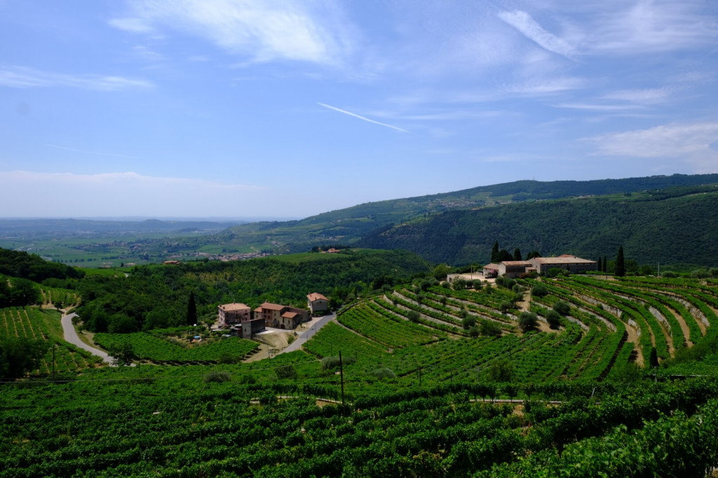
The Valpolicella Park
Valpolicella Park covers approximately 50 hectares across the municipalities of Fumane and Marano di Valpolicella. Once used for quarrying, the area has been transformed through environmental restoration projects that enhanced its landscape and ecological value. Since 2019, the park has been jointly managed by the two municipalities under an agreement with the landowner.
The park is known for its remarkable variety of natural habitats: from dry meadows to mountain woodlands, from vineyards and olive groves on the slopes to wetland areas created around two artificial lakes. This ecological diversity supports numerous animal and plant species, many of which are listed in the Annexes of the European Union’s Habitats Directive, and are therefore considered of particular conservation value.
The park’s trails are open year-round and suitable for all levels of hikers. Each season offers a unique experience, with spring and autumn standing out for the vibrant colors and ever-changing scenery.
Purano
As you enter the village of Purano, coming up the road from the park, you can still see traces of the original rural layout. The radial road pattern, with farmyards and courtyards gathered around the historic center, has preserved the traditional structure of the settlement.
The Church of San Giorgio, originally Romanesque in design, is first mentioned in the 15th century. However, its current appearance dates back to the early 18th century, when it was transformed with elegant Baroque features. The interior has a single nave leading to a triumphal arch and a square apse, where a marble altar stands beneath a painting of Saint George slaying the dragon.
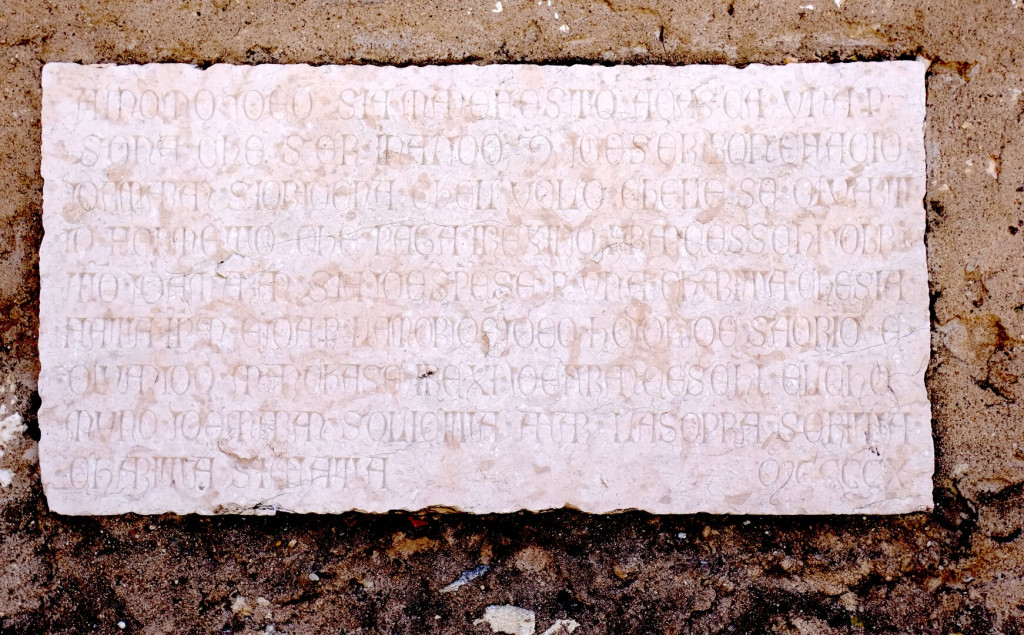
On one of the side walls, there is a valuable historical record: a stone inscription from 1410 commemorates a donation by a man named Franceschino, who left instructions in his will that his heirs—under the supervision of the Municipality of Marano—should use the income from a parcel of land to provide bread for the poor during the patron saint’s feast day. The amount specified was 43 kilograms of bread.
Opposite the church square, you’ll notice a curious element: an ancient column with a Latin inscription, placed on a large stone base. This base was originally the counterweight of a wine or olive press, a type that has long since fallen out of use—disappeared for about two centuries.
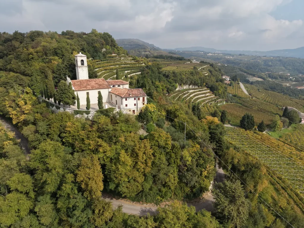
Santa Maria Valverde
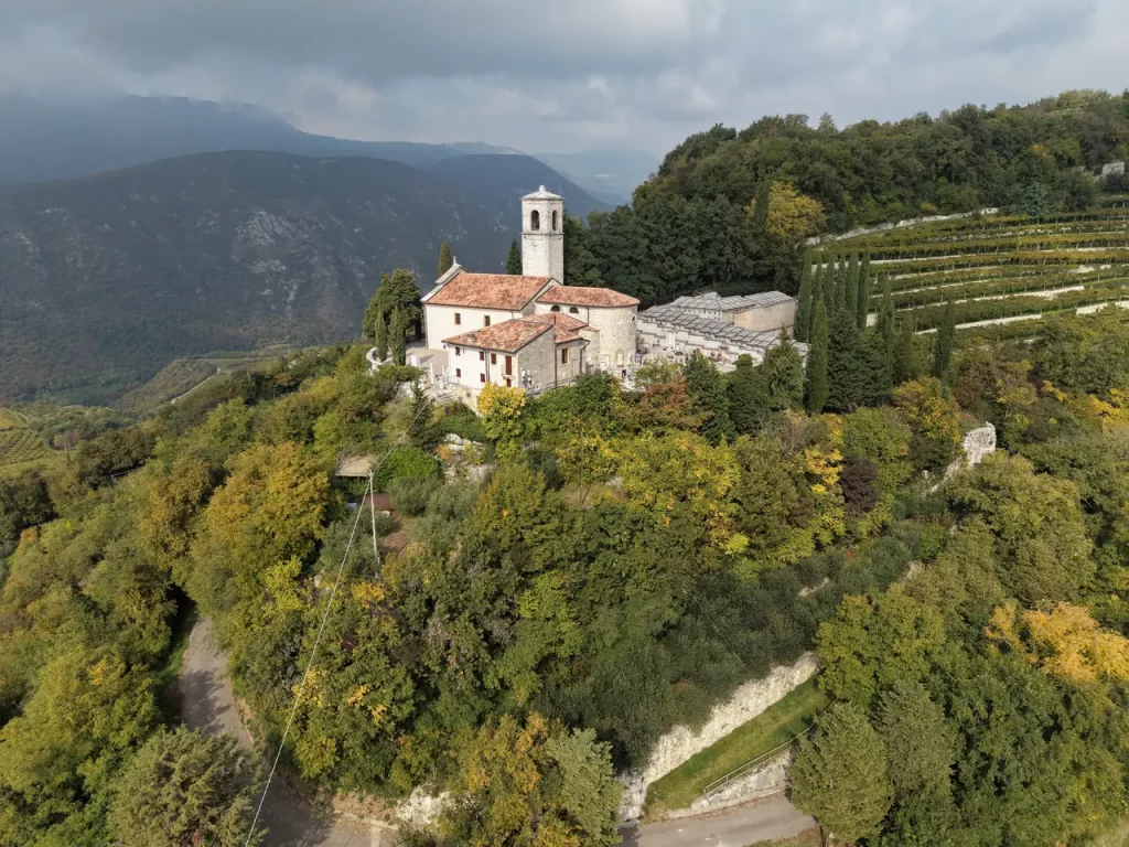
The area around Santa Maria Valverde is one of the most captivating scenic viewpoints in all of Valpolicella. Simply sitting on the low wall in front of the church is enough to enjoy a breathtaking view: in the foreground, the rural courtyards of Purano, followed by the valleys of Marano and Fumane; then the gaze opens wide over the entire western Veronese arc, from Monte Pastello to Lake Garda, with its moraine hills, all the way to the distant skyline of the city of Verona.
Another striking perspective can be found by leaning over the stone wall of the small adjacent cemetery, which—despite recent expansions—still retains the quiet, intimate atmosphere of old rural cemeteries. On the apse of the church, a nineteenth-century plaque commemorates a cholera epidemic that struck the area in the mid-1800s.
The current building is the result of several renovations over time. The first, in the second half of the 17th century, is recorded in inscriptions on the apse and bell tower. A second, more substantial restoration took place around two centuries ago, during which the panoramic courtyard was also laid out.
The interior is bright and harmonious, with simple yet well-preserved architectural elements that invite a moment of pause. It’s a perfect spot to admire the craftsmanship of the structure and appreciate the deep connection between the building and the surrounding landscape.
The Temple of Minerva
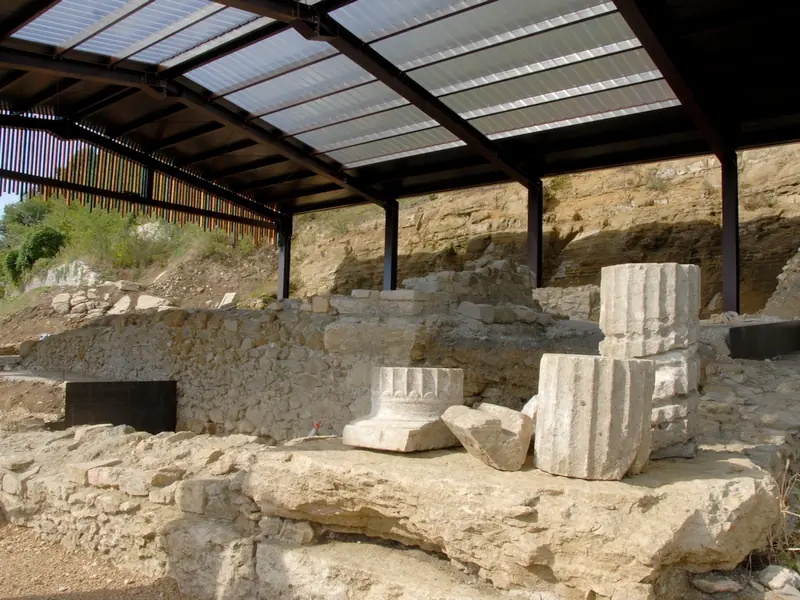
Along the trail, near the summit of Monte Castelon, hikers encounter one of the most significant archaeological sites in the area, overlooking both the Marano Valley and the heart of central Valpolicella.
On a plateau close to the top, excavations carried out between 2007 and 2019 by the Superintendence, in collaboration with the Municipality of Marano di Valpolicella, uncovered a multi-layered complex, revealing a long and continuous human presence in the area.
The site preserves the remains of three overlapping construction phases:
- A votive pyre from the Protohistoric period (6th–2nd century BCE), containing a deposit rich in organic and charred materials, including botanical and animal remains.
- A Roman temple from the Republican era (late 2nd century BCE), which yielded numerous wall paintings in the First Pompeian Style—now considered among the most important of the region.
- A second temple from the Augustan age, recognizable by its opus reticulatum masonry and cocciopesto flooring.
Among the finds are coins, rings, fragments of statues, and decorative objects, all of which point to the site’s importance in antiquity.
The structures have been restored and made accessible, and an equipped path connects the archaeological area to the nearby church of Santa Maria Valverde. A protective roof allows visitors to view the remains up close, all within a setting of remarkable natural and scenic beauty.
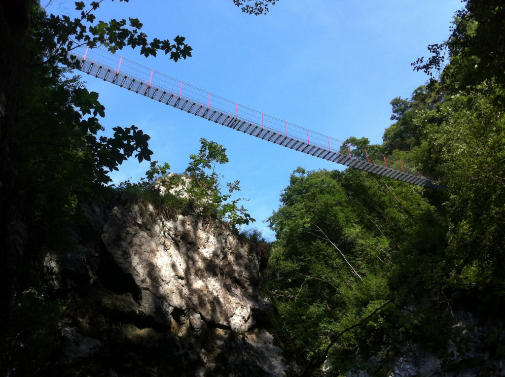
Malga Biancari and the Tibetan Bridge
Along the trail, Malga Biancari is well worth a stop. Once an old communal dairy hut (known locally as a casello turnario), it was built and managed collectively by local farmers, following a system similar to a cooperative. Each member brought the milk from their own cows, took turns processing it, and shared the final product—butter and cheese—which was then sold collectively.
The interior of the malga was divided into two main rooms. At the back, facing north and sheltered from the sun, was the “logo del late”, where freshly milked milk was left to rest, allowing the cream to rise to the surface. This cream was collected using wooden tools—such as the burcio or zangola—and churned into butter.
The skimmed milk was then poured into a large cauldron in the warmer room, known as the “logo del fogo”. Here it was heated and, with the addition of rennet, transformed into cheese for aging.
Today, the building is owned by the Municipality of Marano di Valpolicella and managed by the local Pro Loco association, which has turned it into a cultural and information point for hikers and visitors heading to the nearby suspension bridge.
Just beside the malga stands the spectacular Tibetan Bridge of Valsorda, inaugurated in 2012: a 53-meter-long aerial walkway, suspended about 420 meters above the valley floor. Designed with great care for the natural landscape, the bridge blends in gracefully and offers breathtaking views over Valsorda, one of the most dramatic gorges in the province of Verona.
The bridge is safe and accessible, offering not only a light and enjoyable challenge but also a powerful symbol of connection—between past and present, between rural tradition and the modern appreciation of this remarkable landscape.
The Fumane Cave
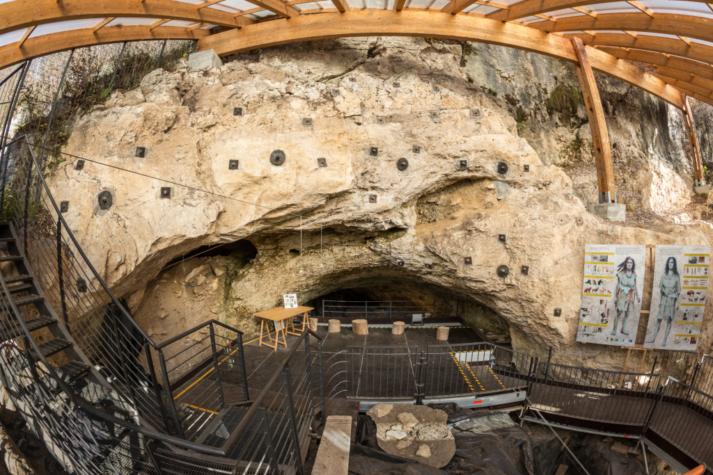
Just above Molin del Cao, along the ancient trail connecting Fumane to Molina, lies the Fumane Cave—one of the most important prehistoric sites in Europe. This rock shelter was inhabited continuously by both Homo neanderthalensis and Homo sapiens between 60,000 and 30,000 years ago, while animal remains found at the site date back as far as 90,000 years.
Today, the cave is easily accessible via a short detour on foot and offers a remarkable opportunity to explore the origins of modern humans and their ability to adapt to diverse environments.
Among the most fascinating discoveries are ochre drawings found on the rock walls, dated to around 35,000 years ago—some of the oldest known artistic expressions. One of the most iconic images depicts a horned figure, possibly a shaman or ritual leader, holding a votive object. Another drawing shows an animal—perhaps a feline or mustelid—revealing the symbolic richness of prehistoric imagination.
Archaeological excavations have unearthed flint tools, bone instruments, ornaments, marine shells, and worked deer teeth, indicating a surprisingly advanced cultural level for the time. The analysis of animal remains revealed the presence of foxes, hyenas, wolves, brown bears, lynxes, wildcats, and even cave lions, providing a detailed picture of the natural environment of that era.
The site was likely seasonal, used from spring to autumn, while during the colder months, people probably migrated to milder areas.
Today, the cave can be visited by reservation, often with the guidance of specialized archaeological tour leaders, and is a highly recommended stop for those exploring the area in search of the deep roots of human history.
Molina and the Waterfall Park
At the end of the Fumane Valley, near the small village of Molina, lies the Waterfall Park, a natural area within the Lessinia Regional Park. The park was created thanks in part to the efforts of naturalist Brother Giuseppe Perin, and is now managed by the local Pro Loco association.
Here, in a landscape where several small valleys meet, the streams create a series of spectacular waterfalls, shaped by a unique geological formation. The area can be explored along well-maintained trails, most of which are easy to follow, winding through quiet, shady woods and offering a full immersion in nature.
Molina is one of the most striking examples of a traditional stone village in the Lessinia region. Houses, roofs, courtyards, and fences are all built using large slabs of local stone, worked with remarkable craftsmanship. The village is arranged around a series of stone-paved courtyards, marked by monumental archways and, in some cases, old towers once used as dovecotes.
The name Molina comes from the many watermills that existed here since the Middle Ages, powered by the abundant springs flowing down from the mountains. These mills ground grain and walnuts, and water power was also used for fulling cloth. One of these, the Lorenzo Mill, located in the northern part of the village, has been restored and made operational again by the Pro Loco, complete with all its original milling equipment.